Mountain Biking
The Yampa Valley is home to an ever-expanding system of multi-use trails of varying length, difficulty, and proximity to town. RCR works with Adventure Maps to produce a waterproof, packable trail map specific to area riding zones, which you can purchase through the RCR Webstore – or at many of the bike shops around town. There are also several fantastic mobile apps that will help you find your way around the trails, including Trailforks, COTREX, and MTB Project.

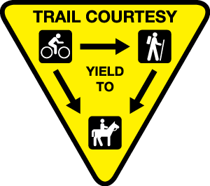
Exercise friendly trail courtesy. Bikes yield to equestrians + hikers. It is common practice for bikers and hikers to yield to whoever is the uphill user – that is, the user who is grunting their way uphill!
RCR works with a list of local land managers to host trail maintenance and construction work days, communicate up-to-date trail alerts and reminders of wildlife closures, and MUCH more. We advocate for responsible trail development and cultivate close working relationships with our project partners. Click below to learn more about these agency partners and the riding areas they manage in and around Steamboat:
Bureau of Land Management – Little Snake Field Office
GET INVOLVED
There are several local commissions, roundtables, committees and boards that meet on a monthly or quarterly basis and discuss all things recreation-based in Northwest Colorado. If you want to become more involved in the future of mountain biking and multi-use trails in the area, we suggest connecting with these processes directly. Level of public participation in these meetings will vary, but there are typically public comment periods during which you can speak up or ask questions.


